Showing posts with label sem 8. Show all posts
Monday, April 16, 2012
Advance Computer Networks : [BE-IT] Elective
10:59 AM
acn, Advance Computer Network, BE Pune University, CN, Computer networks, elective, IT, sem 8, tcp
2 comments
Advance Computer Networks
Unit I Introduction
Requirements , Network architecture , Networking principles, Network services and Layered architecture , Network services and Layered architecture , Future networks ( Internet , ATM , Cable TV, Wireless – Bluetooth, Wi-Fi, WiMax, Cell phone )
Unit II Advanced Technologies
Virtual circuits, Fixed size packets, Small size packets, Integrated service, History, Challenges, ATM Network protocols, IP over ATM, Wireless networks : Wireless communication basics, architecture, mobility management, wireless network protocols. Ad-hoc networks Basic concepts, routing; Bluetooth
(802.15.1), Wi-Fi (802.11), WiMAX (802.16), Optical Network : links, WDM system, Optical LANs, Optical paths and networks.
Unit III Performance of Networks
Control of networks: objectives and methods of control, Circuit switched networks, Datagram and ATM networks. Mathematical background for control of networks like Circuit switched networks, Datagram and ATM networks
Unit IV Advanced Routing - I
Routing architecture , Routing between peers ( BGP) , IP switching and Multi- Protocol Label Switching (MPLS), MPLS Architecture and related protocols , Traffic Engineering (TE) and TE with MPLS , NAT and Virtual Private Networks (L2, L3, and Hybrid), CIDR –Introduction , CIDR addressing, CIDR
address blocks and Bit masks
Unit V Advanced Routing - II
Mobile IP- characteristics, Mobile IP operation, Security related issues. Mobility in networks. Voice and Video over IP (RTP, RSVP, QoS) IPv6: Why IPv6, basic protocol, extensions and options, support for QoS, security, etc., neighbor discovery, auto-configuration, routing. Changes to other protocols. Application
Programming Interface for IPv6.
Unit VI Ad Hoc Networking
An Introduction, A DoD Perspective on Mobile Ad Hoc Networks, DSDV: Routing over a Multihop Wireless Network of Mobile Computers, Cluster-Based Networks, DSR: The Dynamic Source Routing Protocol for Multihop Wireless Ad Hoc Networks
Download Books
Computer Networks: A Systems Approach
Larry L. Peterson, Bruce S
File Type :PDF
----------------------------------------------------------
Internetworking with TCP/IP
Douglas E. Comer
File Type :PDF
--------------------------------------------------------------------------------------------
Thursday, March 8, 2012
Geo Informatics System : GIS [Elective] - BE- IT
5:24 AM
BE Pune University, elective, Geo Informatics System, geographic, geographic Information system, GIS, IT, sem 8
1 comment
New Update : 19 May 2012
-------------------------------------------------------------------------------
GIS : UNIT 6
Type : PDF
Size : 2.5 MB
Comments : Scanned Copy
------------------------------------------------------------------------------
Geo Informatics System (GIS) is an elective subject introduced into the final year, final semester of Information Technology Engineering og Pune University. The subject is vast and was introduced for the first time in 2012 for the 2008 pattern.
The Syllabus for the subject is as follows:
Unit I: Digital Image Processing Fundamentals
Basic character of digital images, preprocessing, registration, enhancement, spatial filtering, transformations, classification, Visual Image Interpretation: Types of pictorial data products, image interpretation strategy, image interpretation process, basic elements of image interpretation.
Unit II: Foundations of Remote Sensing
Basic Principles of remote sensing, Electromagnetic remote sensing process, Microwave Remote Sensing:
The radar Principle, factors affecting microwave measurements, radar wavebands, SLAR Systems , SAR, Interpreting SAR images, geometrical Remote Sensing platform and Sensors: Satellite system parameters, sensor parameters, imaging sensor systems, Earth recourses satellite series.
Unit III: GIS Fundamentals
GIS: Definition, evolution, components, approaches, Geospatial data, GIS operations.
GIS architecture, models of GIS, framework for GIS, GIS categories, level / scales of measurement. Map projections, Map as a model, classification of maps, map scale, cartographic symbolization, types of map, spatial referencing system, map projections, grid systems, computer in map production, digital database in a GIS, linkage of GIS to remote sensing
Unit IV: Spatial Data Management
Existing GIS data, Metadata, conversion of existing data, creating new data, geometric transformations, Describing data quality and errors, Sources of errors in GIS, Finding and modeling errors in GIS, Managing GIS error, types of errors- RMS error, location error, topological error, spatial data accuracy. Attribute data in GIS, Spatial data processing.
Unit V Data Modeling and Analysis
Data Exploration, types of data queries, Vector data analysis- buffering, overlay, distance measurement, pattern analysis, Raster Data analysisdifferent types of operations, comparison of vector and raster based data analysis. Basic elements of GIS modeling- Binary models, Index models, Process
models
Unit VI: Applications and development
Urban and Municipal Applications- introduction and methodology. GIS implementation and Project Management – Software Engg. as applied to GIS, GIS project planning, System Analysis and user requirements studies, geospatial database design methodology, GIS application software design methodology, system implementation and maintenance, Geospatial Information Domain, issues and trends in GIS development.
Remote Sensing and Geographical Information Systems
M. Anji Reddi
(Syllabus Recommended)
Alternative Download
TYPE :DJVU
SIZE : 7.5 MB
(The Above File is in DJVU format)
(Download WinDJView to open DJVU File)
-------------------------------------------
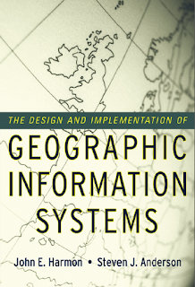
The Design and Implementation of
Geographic Information Systems
John Harmon, Stephen Anderson
Download Now
-----------------------------------------------
TYPE :DJVU
SIZE : 7.5 MB
(The Above File is in DJVU format)
(Download WinDJView to open DJVU File)
-------------------------------------------
The Design and Implementation of
Geographic Information Systems
John Harmon, Stephen Anderson
Download Now
TYPE : PDF
SIZe : 2.6 MB
-----------------------------------------------
Managing Geographic Information Systems
Nancy Obermeyer, Jeffrey Pinto
TYPE : PDF
SIZE : 2MB
------------------------------------------------
Subscribe to:
Posts (Atom)


